Contexts
(Re)colonizing Tradition
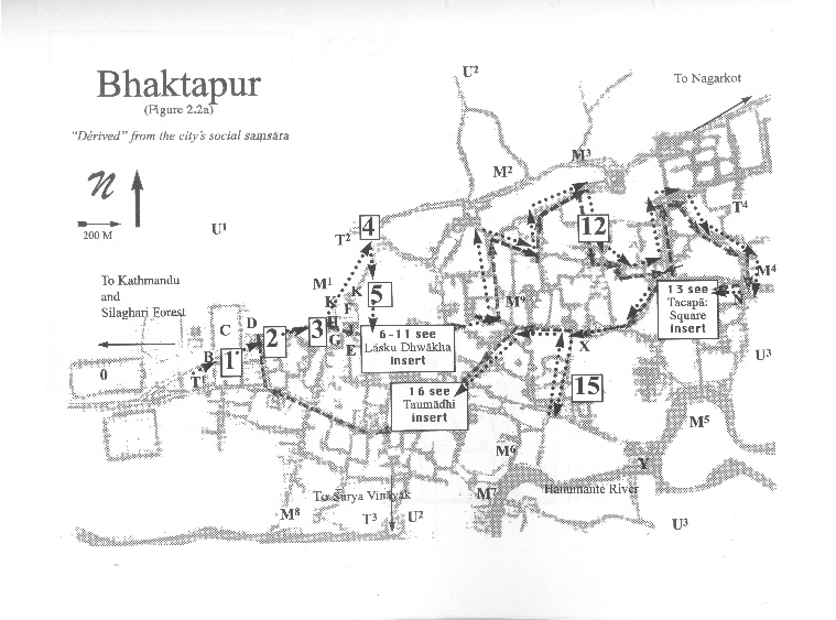
A Pedestrian Guide to a "Traditional" City
Welcome to Bhaktapur
[1] The Tea Stall at Guhepukhu
[2] Nava Durga Chitra Mandir
[3] Khauma Square
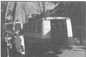
[4] Tourist Motor Park
[5] Indrani Pitha
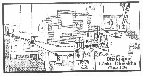
[6]Lasku Dhwakha Gate
[7]Char Dham
[8]Cafe de Temple
[9]Batsala Temple
[10] Batsala Temple
[11] City Hall
[12] The Procession Route
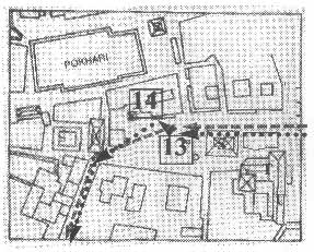
[13] Pujari Math
[14] The Peacock Restaurant
[15] Sewage Collection Ponds
[16] Bhairavanath Temple
|
Welcome to Bhaktapur
Signs of a Traditional City
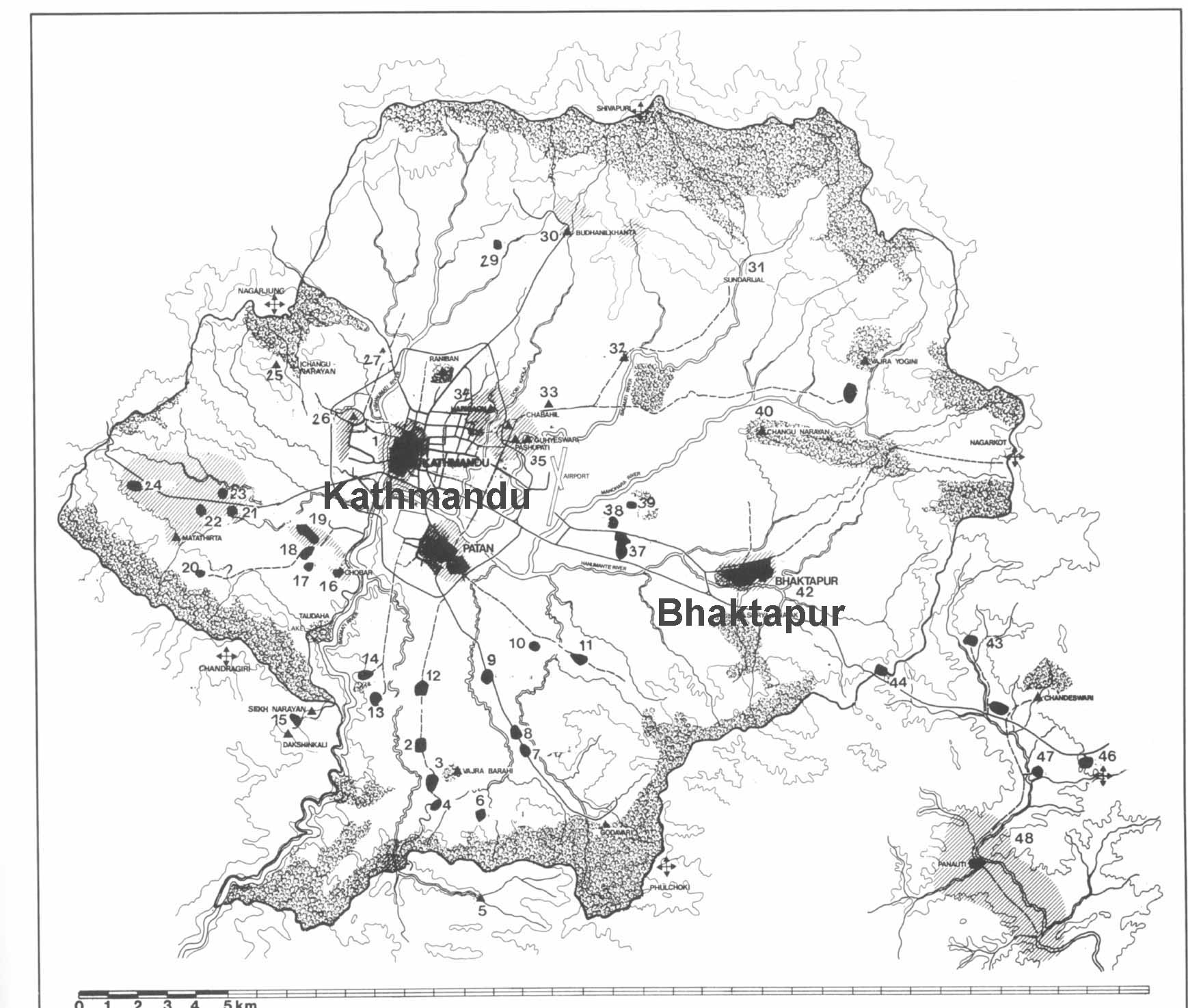
 The aim of this site is to orient you the reader to Bhaktapurąs thick web of lived reality, so as to understand how it has been colonized and re-colonized. Bhaktapur lies 11 kilometers east of Nepaląs capital, Kathmandu,. The quickest route from Kathmandu to Bhaktapur is via the express bus that turns off the Arniko Highway and heads uphill through the Silaghari Forest area past a large red Coca-Cola sign. Under the Coca-Cola advertisement is a smaller blue sign with a silhouette reproduction of Bhaktapurąs temple skyline, over which is written in white block Roman letters, "Welcome to Bhaktapur."
Just in front of these, in the roundabout in the middle of the road, is an even smaller sign that reads in Nepali, "Preserve our historic city." While placed here by different groups and for different reasons, these signs all indicate that Bhaktapur is a traditional city. In fact, they are just a few of the many signs left by the Nepalese government, the local municipality, foreign development agencies, and tourist institutions that welcome the visitor to Bhaktapur, Nepaląs "Hindu medieval city," the nationąs "cultural capital." Moreover, as became clear in my interviews, Bhaktapurąs residents also tended to imagine the city as "traditional," as opposed to the valleyąs two other major cities, Patan and Kathmandu (as well as to the "West"), which in their opinion had become modern and developed.
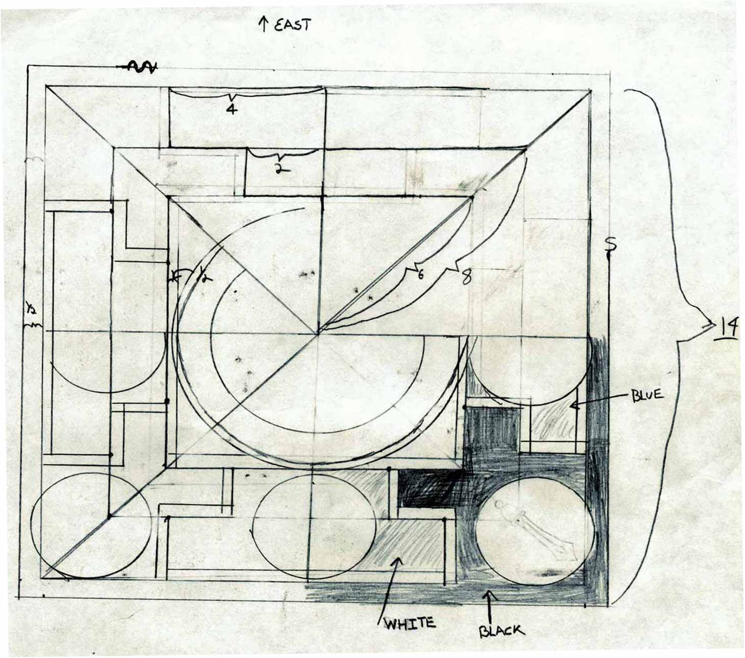
What is the "experience" of a traditional city? My basic argument is that lived worlds are a temporality that is formed by a shuttling between individual pedestrian knowledges and social maps. Yet, there is not one "master map" of Bhaktapur. Accordingly, I concentrate on the social logics of three chief ones: the cadastral logic of the mandala map, the commodification of the tourist map , and the governmentality of the government map.
  
|
Maps
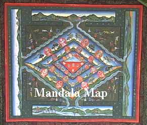
Mandala Map
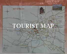
Tourist Map
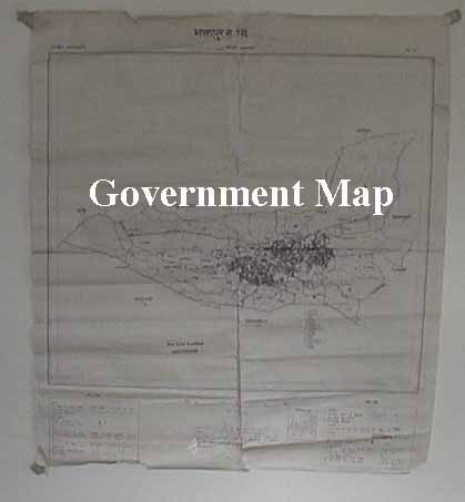
Government
Map
Pedestrian
Tour Map
Bhaktapur
Durbar Square
Tacapa Map
Satellite
Photograph
Kathmandu
Valley
Goddesses
|